Paddling around Bell Island is a classic day paddle near St. John's. Once you've done it, you can safely call yourself an intermediate sea kayaker. It tends to be a popular paddle for groups and the local crowd usually does it a couple times a summer. For some reason, I had never been around Bell Island before. The photo above shows the high seacliffs that characterize the island. There are few good landing spots, the swell from the north can be huge, and Bell Island Tickle has a nasty reputation for sudden rough water when the wind opposes the tide.
The weather gods smiled on us on 22 Septemeber 2007. David Carroll organized the trip and a dozen people jumped aboard.
 The map shows the route of 25 km. We loaded our vehicles and kayaks aboard the Bell Island ferry at 8:30am.
 The crew were a little puzzled by the sudden invasion of kayakers.
 Since the sun was out, we headed for the observation deck. Here's the gang with David and his father Joe Carroll in the front.
 Here's the put-in not far from the ferry dock on the island. There was almost no swell on this side.
 We headed north along the towering cliffs.
  After a few minutes of paddling, we came to this 100 metre tunnel through the cliff. The swell was bigger here and crashing inside the tunnel. So we debated and then decided to give it a pass.
 Ralph is paddling strongly through the increasing swell on the north side of the island. The lighthouse is on top of the cliff in the background.
 Here's the swell breaking on the shoals and seacliffs.
 We started south down the back side of the island. Here is David with some nice waves behind him.
 More swell breaking on shoals. Below the seabed here are tunnels from the large iron ore mines that operated on Bell Island for decades. During the Second World War, these were the largest iron ore mines in the British Empire.
 Here's Stan MacKenzie taking photos near the Grebes Nest.
  Continuing south, we came to the Bell which gives the island its name. The folks in the distance are sprinting for the lunch beach.
 The channel between the Bell and the main island offered some interesting swell, which Alison took advantage of.
 David at the lunch beach. Little Bell is behind him. I should probably title this photo "Spot the Knob", but I don't want to get David cranky with me.
 Here's Little Bell, the Bell, and the lunch beach. Spectacular spot!
 Continuing on around the south end of the island, we came to the Clapper.
 Here's Stan paddling by Lance Cove. This is where a German U-boat sank four ships during World War II. One of the U-boat's torpedos exploded on the beach in Lance Cove. Things were not quite as exciting the day we were there. But the sun was great!
 We finished up around 2:30pm. A bunch of us set off in search of an ice cream cone to celebrate the day, before heading back on the ferry. A great trip with a great bunch of friends!


 As we pulled further south, the Cape St. Mary's lighthouse came into clear view.


 Here's a close-up photo of the adult gannets (white) and the large gannet chicks (brown).
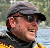
 From the big smile on Ian's face it's not hard to tell he was enjoying the trip.