On Day 3, we paddled 34 kilometres from Little Bay Islands to south to Sunday Cove. (Click on the map and photos to see larger views.)
 We awoke to glass calm in North Harbour on Little Bay Islands. We had a favourable weather forecast, so we decided to complete our circuit of Little Bay Islands, and then head south.
 As we paddled out of North Harbour, we passed these icebergs. So big, they took our breath away. We continued north around Northern Head and then west along the rugged north side of Little Bay Islands. The swell was bigger on this exposed coastline. We rounded Burnt Head and paddled south.
 At Western Cove, we found this excellent campsite with a wonderful view.
  Here's another great campsite at Murcell Cove on the west side of Little Bay Islands.
  Paddling south down the west side of Little Bay Islands was an enjoyable mix of rugged headlands and coves.
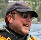
 Leaving Little Bay Islands at Hynes Point, we steered southwest into an archipelago of small islands. We decided to land on Red Island above for a short break to stretch our legs.
 The view to the north from Red Island was captivating with the fog shrouding the islands and ridges towards Beachside.
 Here is the ferry "Inch Arran" that runs from Shoal Arm to Little Bay Islands. You can see the fog bank in the background. The ferry passed by Red Island on the way to Little Bay Islands, while we were taking a break.
We left Red Island and paddled south into Halls Bay. We followed the west shore of Halls Bay towards Saltwater Pond Bay.

Here's an interesting rock we passed along the way. Indian Beach offered a good campsite.
 Here's the view looking south into Halls Bay, with Sunday Cove Island on the left and Indian Beach on the right. We had a beautiful sunny day with little wind. We took another break at Saltwater Pond Bay. Then we crossed Halls Bay, going south to Sunday Cove Island.
 Here's Isabelle in front of an odd two-floor cabin on a small island near Sunday Cove Tickle. We paddled through the Tickle and on to Nippers Harbour, in search of a campsite. Unfortunately Nippers Harbour was muddy and mostly salt marsh. No suitable campsite there. We continued on to Stag Cove. Again good campsites were at a premium.
 In a pinch, we decided to camp on this dock. There was no cabin here, but there was a first-class outhouse and stream. Another unusual but comfortable campsite. After a long day and 34 kilometres of paddling, we did not complain. A hot supper, a quick bath beside the stream and we were quickly off to sleep with the water lapping gently on the dock.


 There were 7 icebergs visible across Note Dame Bay on this crossing.